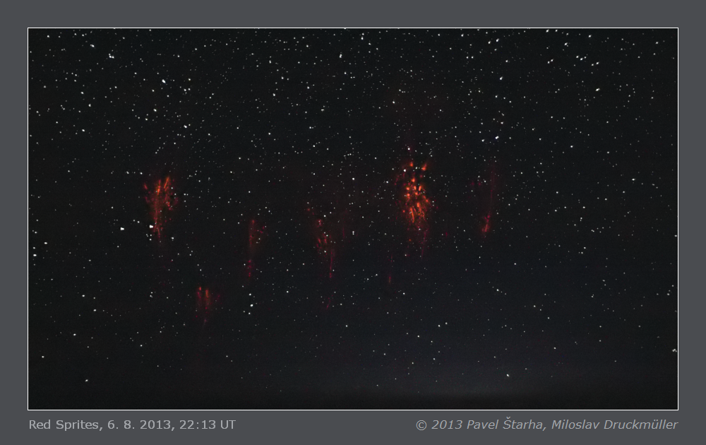
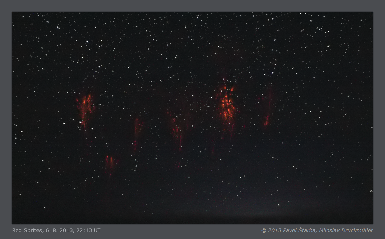
6. 8. 2013, 22:13 UT
This group of red sprites was visible above the western horizon in the altitude from 10° to
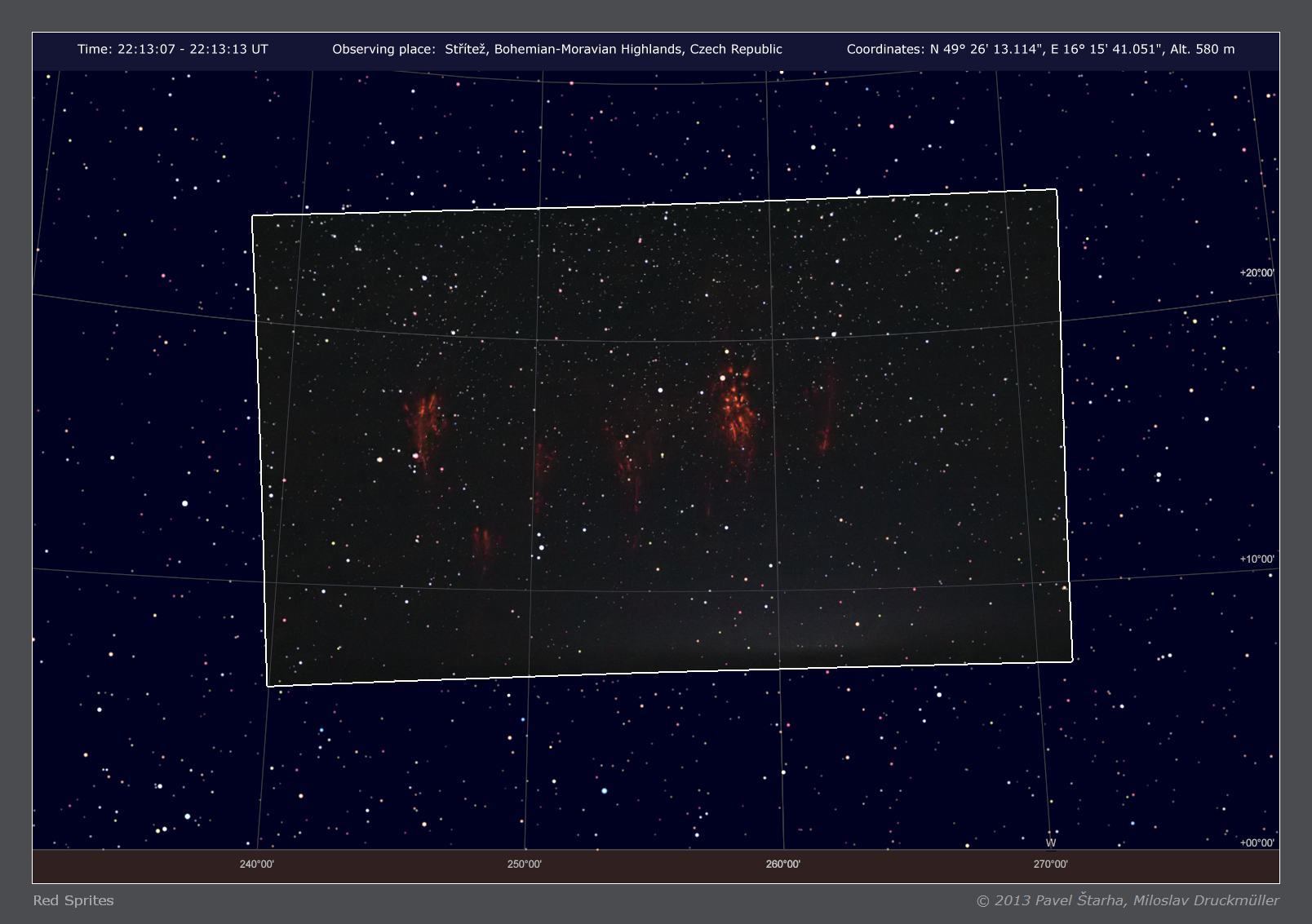
22°. The exact position of the red sprites in the sky is shown in this
star map generated by the Sky Charts software.
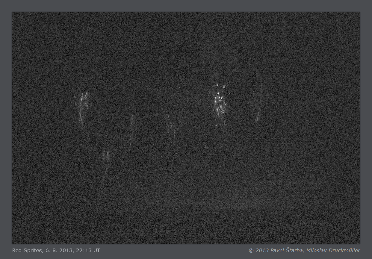
- B&W image with subtracted stars showing the red channel only
(without noise filtration)
Click on the image or on the following reference to display the
higher resolution image version (964 KB, PNG format).
|
| Image | HN3A0729.png |
| Date | 6. 8. 2013 |
| Time | 22:13:07 - 22:01:13 UT (time according to GPS) |
| Place | Střítež, Bohemian-Moravian Highlands, Czech Republic |
| Coordinate | N 49° 26' 13.114", E 16° 15' 41.051", Alt. 580 m |
| Optics | Pentacon 1.8/50mm (set to F 2.0) |
| Camera | Canon EOS 1D Mark II |
| Exposure | 6 s, ISO 3200 |
| Processing | Images taken by Pavel Štarha, image processing by Miloslav Druckmüller |
| Copyright | © 2013 Pavel Štarha, Miloslav Druckmüller |
|
Miloslav Druckmüller
Institute of Mathematics, Faculty of Mechanical Engineering
Brno University of Technology, Czech Republic
druckmuller@fme.vutbr.cz
|
Page last update: 18.8.2013
|
|